Shoreland Zoning Basics Around Lake Onalaska

December 4, 2025

If you dream about sunrise paddles on Lake Onalaska or grilling on a deck with water views, you also need to know what shoreland zoning means for your plans. These rules shape where you can build, how you manage vegetation, and what you can add along the shoreline. The good news is that a little prep goes a long way. In this guide, you’ll learn how shoreland zoning works around Lake Onalaska, who to contact, and the practical steps to keep your project or purchase on track. Let’s dive in.

What shoreland zoning is

Shoreland zoning protects water quality, habitat, and public access by setting standards for land use near lakes, rivers, and streams. In Wisconsin, the state sets minimum requirements through NR 115 in the administrative code. Local governments then adopt and enforce their own ordinances that meet or exceed those minimums.

You will see two layers at work. The state provides the baseline. The county or city applies the rules on your specific parcel. Because local ordinances can be more restrictive, always check the local code and staff for the exact standards on your lot.

Who regulates Lake Onalaska parcels

Lake Onalaska is part of the Mississippi River system and is treated as a navigable waterbody. That brings a mix of local and state oversight, and sometimes federal review for in‑water work.

  • La Crosse County Zoning Department handles shoreland zoning and related permits in unincorporated areas around the lake.
  • The City of Onalaska manages zoning and building permits inside city limits. Some shoreline lies within the city, so jurisdiction can change parcel by parcel.
  • Wisconsin Department of Natural Resources (DNR) oversees permits for many activities in or directly along navigable waters, such as certain docks, riprap, or dredging.
  • The U.S. Army Corps of Engineers may be involved for some projects on the Mississippi River and its impoundments.

A quick call to the county or city will confirm who regulates your lot and where to start.

Where the shoreland zone begins

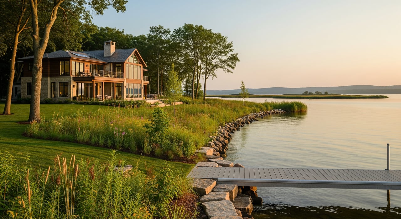
Shoreland rules apply within a set distance of the Ordinary High‑Water Mark, often called the OHWM. The OHWM is identified by field indicators like vegetation, soil changes, and debris lines. It can be mapped or confirmed in the field.

Why it matters: setbacks, buffer rules, and some permit triggers are measured from the OHWM. If you are planning any additions, new structures, or shoreline work, expect to provide a current survey or site plan that shows the OHWM and property lines.

Common rules that affect your plans

Every ordinance is different, but most shoreland programs around Lake Onalaska manage a few key areas.

Setbacks for homes and additions

Local rules set minimum distances from the OHWM for new homes, garages, decks, and other structures. If your house was built before today’s standards, it may be closer to the water than current rules allow. Expanding closer to the water is usually limited and may require a variance. Always verify with the city or county before you design work.

Vegetation and shoreline buffers

Many ordinances limit removal of trees and shrubs near the water to protect natural filtration and reduce erosion. Selective trimming is often possible, but large clearing or grading can trigger mitigation or permits. Ask about what you can do within a defined viewing corridor and what restoration may be required.

Impervious surfaces and grading

Driveways, patios, roofs, and other hard surfaces increase runoff. Local codes often cap impervious area within shoreland zones and regulate regrading. If you plan to add a patio or expand a driveway, check how the change affects your impervious totals.

Docks, piers, lifts, and boathouses

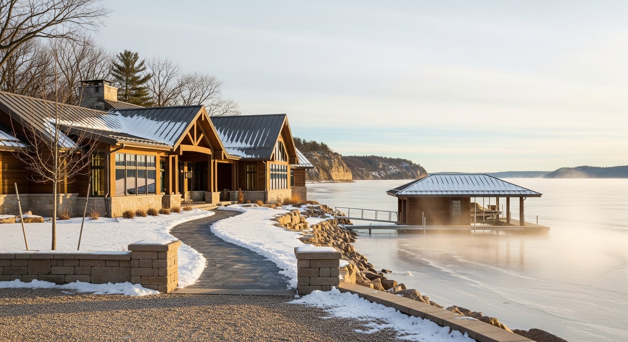
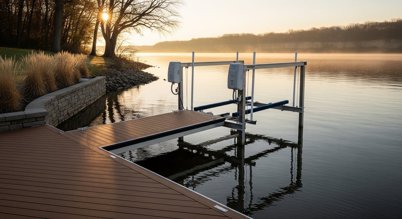
Upland structures and in‑water structures are handled differently. Many docks, lifts, and boathouses require local approvals, and some projects also require DNR review. Design, size, and location all matter. Before you buy materials or sign a contract, confirm whether your setup fits general exemptions or needs permits.

Shoreline stabilization and riprap

Erosion control is important, but techniques like riprap, seawalls, beach creation, and dredging often trigger DNR review under state waterways rules. Additional county or city permits may also be needed. Early coordination helps you choose a method that fits your shoreline and the rules.

Septic systems near the lake

If a parcel uses a private onsite wastewater system, siting and replacement standards apply. A failing or undersized system can affect financing and sale timelines. Get inspection records and talk with county environmental health staff about replacement options and setbacks.

Shoreland wetlands

Wetlands within the shoreland zone carry extra protections. Altering them may require state and federal permits. Always check maps and consult staff before you grade, fill, or re-route drainage.

Nonconforming structures and variances

Older lake homes often have features that do not meet current rules. Many can remain but have limits on expansion or reconstruction. If you need relief from a standard, local zoning boards manage variance requests. A strong application includes a clear site plan, OHWM location, and reasons tied to the property’s unique conditions.

A simple checklist before you buy or build

Use this step‑by‑step list to save time and avoid costly redesigns.

  1. Confirm jurisdiction
    • Determine if the parcel is inside the City of Onalaska or in unincorporated La Crosse County. This decides which office will review your plans.
  2. Pull maps and zoning
    • Ask the county or city for the parcel’s base zoning, shoreland overlays, floodplain, and any mapped wetlands. County GIS and local zoning offices can provide these layers.
  3. Request a permit history or compliance letter
    • A written zoning compliance letter and a list of past permits help buyers verify what exists today and whether there are open issues.
  4. Locate the OHWM
    • Ask how the OHWM is determined on your lot and whether a current survey is needed. For most projects, you will want a site plan that shows the OHWM.
  5. Check floodplain and wetlands
    • Review FEMA flood maps and DNR wetland maps along with county layers to see if special standards apply.
  6. Scope your project and call the right offices
    • For new structures, additions, grading, or vegetation work, call city or county zoning first. For docks, shoreline stabilization, dredging, or work in the water, contact DNR waterways staff.
  7. Address nonconforming issues early
    • If the home or boathouse is closer to the water than current rules allow, talk with zoning staff about limits and whether a variance is an option.
  8. Gather documentation
    • Sellers should collect surveys, past permits, and as‑built plans. Buyers should ask for these during due diligence.

Real‑world scenarios and how to navigate

You want to add a lakeside deck

  • Start by confirming the OHWM and the current setback. Even a small deck expansion can be limited by the shoreland setback.
  • Ask zoning staff if mitigation, such as buffer plantings, is required for additional impervious surface.
  • Provide a simple sketch or site plan with measurements to speed review.

You plan to install a dock and lift

  • Check local approval needs for your shoreline frontage and neighborhood. Then contact DNR waterways to learn if your design fits a general exemption or needs a state permit.
  • Keep records of location, size, and seasonal removal plans if required.

You need to stabilize an eroding bank

  • Talk with DNR about suitable techniques and permit thresholds. Naturalized solutions may be encouraged in some locations.
  • Coordinate with the county or city for any local shoreland or grading permits.

You hope to open up the view

  • Ask zoning staff about allowable selective pruning within a viewing corridor. Whole‑scale tree removal or grading near the water often requires permits and mitigation.
  • Plan for replanting or buffer restoration if it is part of the approval.

You discovered an aging septic system

  • Request inspection reports and service records. Contact county environmental health to learn about replacement options and siting standards near the lake.
  • Build replacement timelines into your purchase or sale planning.

You own a nonconforming boathouse

  • Confirm its legal status and limits on repair or expansion. Some routine maintenance is allowed, but enlargement or relocation often requires special approval.
  • Keep photos and past permits on file to document existing conditions.

How to get clear answers fast

Shoreland rules are specific to each parcel. A short, focused call with the right office can save weeks of rework.

  • Start with the City of Onalaska or La Crosse County Zoning Department based on your parcel location. Ask for shoreland zoning standards, the permit process, and staff contacts.
  • For in‑water work or shoreline stabilization, call Wisconsin DNR waterways staff to discuss your concept before you finalize plans.
  • Use county GIS and property records to gather parcel maps, floodplain layers, and any notes about wetlands or the OHWM.
  • If you need help with OHWM location or a variance, consider engaging a local surveyor or civil engineer to prepare a certified site plan.

Work with a local guide who understands the lake

Lake living should feel simple and rewarding. When you have a clear plan and the right contacts, it does. You can lean on a local real estate partner to coordinate due diligence, request parcel records, and help you understand how shoreland rules affect value and future options.

If you are exploring a purchase or planning to sell on or near Lake Onalaska, connect with a neighborhood‑savvy, outdoor‑living pro who understands both the market and the shoreline details that matter. Schedule a conversation with Cam Kelly | OneTrust Real Estate to map out your next steps.

FAQs

What is shoreland zoning around Lake Onalaska?

  • It is a set of local rules, guided by state standards, that governs where and how you can build or alter land near the lake to protect water quality and habitat.

Who decides my setback from the water?

  • The setback is based on local ordinances and measured from the Ordinary High‑Water Mark. City or county zoning staff confirm the standard for your parcel.

Do I need a permit for a dock or boat lift on Lake Onalaska?

  • Many setups require local approval and some need Wisconsin DNR review. Check with your city or county first, then confirm with DNR waterways staff.

Can I remove trees for a better view of the lake?

  • Selective trimming may be allowed, but large‑scale removal or grading near the water is often regulated and may require mitigation or permits.

What if my home is closer to the lake than current rules allow?

  • It may be a legal nonconforming structure. You can often maintain it, but expansions toward the water are usually limited and may require a variance.

Do projects like riprap or seawalls need approval?

  • Yes, most shoreline stabilization work triggers DNR review and may also require county or city permits. Coordinate early to choose an acceptable method.

Will a failing septic system hold up a sale near Lake Onalaska?

  • It can. Buyers and lenders often require inspections and compliance. Contact county environmental health to understand replacement options and timelines.

Buy. Sell. Live the La Crosse Lifestyle

At OneTrust Real Estate, we take the time to understand your unique needs and use our knowledge of La Crosse County’s market to deliver exceptional results. Whether it’s finding your ideal lakeside retreat or securing the best deal for your current property, we’re here to make the process stress-free and rewarding.